Today’s Maximum temperatures will be in the range of 40-42°C. While strong winds are expected during day time.
Partly cloudy sky expected towards evening. Sustained surface winds (SPEED 15-25 KMPH) occasionally gusting to 35 KMPH.
---Advertisement---


IMD Weather Live Updates: The Indian subcontinent is expected to witness an early onset of the Southwest Monsoon in 2025. The India Meteorological Department (IMD) stated that the monsoon is likely to set over Kerala ahead of its normal date. Notably, the Southwest Monsoon has further advanced today into some parts of southeast Arabian Sea, Maldives & Comorin area and some more parts of South Bay of Bengal, Andaman Islands and Andaman Sea. Moreover, conditions are favorable for further advance of southwest Monsoon over some more parts of south Arabian Sea; over Maldives & Comorin area; South Bay of Bengal, remaining parts of Andaman Islands and Andaman Sea; and some parts of central Bay of Bengal during next 3-4 days.
The IMD in its recent update announced that the southwest monsoon is likely to set in over Kerala on May 27, with a model error of 4 days on both sides.
India is witnessing diverse weather patterns, with rainfall in southern states and heatwave in northern states. The IMD continues to issue daily weather update and specific alerts based on the observations. While heatwave grips large parts of northern and central India, with temperatures soaring beyond 44°C, rain alerts remain in effect across coastal and interior regions. Cities like Noida, Patna, Lucknow are experiencing relentless heatwave. Meanwhile, southern and northeastern states are seeing the early effects of the southwest monsoon, bringing thunderstorms, gusty winds, and scattered rainfall.
According to the IMD, rainfall accompanied by thunderstorms and lightning is expected over South Peninsular and adjoining Central India for the next four days.
Northeast India is bracing for heavy to very heavy rainfall, with thunderstorms and lightning forecasted through the next five days (May 16- 20).
In sharp contrast, North India continues to suffer under extreme heat, with heatwave conditions likely between May 16 and 18 in Uttar Pradesh, and May 16 to 17 in West Rajasthan.
You can check all the live updates on daily weather forecast/ condition/ IMD alerts at www.news24online.com
Today’s Maximum temperatures will be in the range of 40-42°C. While strong winds are expected during day time.
Partly cloudy sky expected towards evening. Sustained surface winds (SPEED 15-25 KMPH) occasionally gusting to 35 KMPH.
It’s May 15, and the forecast of the advancement of the monsoon has begun across the country. There is little surprise, as the Indian subcontinent is expected to witness an early onset of the Southwest Monsoon in 2025. The India Meteorological Department (IMD) stated that the monsoon is likely to set over Kerala ahead of its normal date. Notably, the Southwest Monsoon has begun advancing towards Indian mainland, with conditions becoming favourable in Andaman & Nicobar Islands, Andaman Sea and some parts of South Bay of Bengal.
Heat wave conditions very likely in isolated pockets of West Uttar Pradesh during 15th-18th; East Uttar Pradesh during 15th-17th May.
Thunderstorm, lightning & gusty winds speed reaching 30-50 kmph expected over Madhya Pradesh, Vidarbha, Chhattisgarh, Jharkhand, Odisha, Bihar, West Bengal & Sikkim during next 5 days.
Rain to lash Andaman & Nicobar Islands on 15th May.
Dibrugarh has been receiving rainfall for the last two days. Visuals from the city as it experiences rainfall today too.
#watch | Assam: Dibrugarh has been receiving rainfall for the last two days. Visuals from the city as it experiences rainfall today too. As per IMD, the city is likely to experience 'generally cloudy sky with one or two spells of rain or thundershowers' today. pic.twitter.com/ZWDUnrr6nv
— ANI (@ANI) May 15, 2025
Forecast For West India:
Isolated light/moderate rainfall accompanied with thunderstorm, lightning & gusty winds speed reaching 30-50 kmph likely over Konkan & Goa, Madhya Maharashtra, Marathawada during 15th-18th;
Gujarat on 15th May.
Thundersquall wind speed reaching 50-60 kmph gusting to 70 kmph likely over Madhya Maharashtra on 15th May.
Isolated heavy rainfall likely over Madhya Maharashtra on 15th May.
Fairly widespread to widespread light/moderate rainfall accompanied with thunderstorm, lightning & gusty winds speed 30-50 kmph likely over Northeast India during next 5 days with gusty winds speed reaching 50-60 kmph gusting to 70 kmph likely over Assam and Meghalaya.
Isolated heavy rainfall over Arunachal Pradesh during 15th-18th, am on 17th & 18th and Nagaland.
Manipur, Mizoram and Tripura on 15th May with isolated very heavy rainfall over Assam & Meghalaya on 15th & 16th.
Rainfall accompanied with thunderstorms and lightning likely to continue over South Peninsular India & adjoining central India during next 5 days with isolated heavy rainfall over Andhra Pradesh, Karnataka, Kerala and Tamilnadu during next 3-4 days.
Heavy to very heavy rainfall accompanied with thunderstorms & lightning likely over Northeast India during next 5 days and over Sub-Himalayan West Bengal & Sikkim during next 3 days.
मौसम की चेतावनीमुख्य बिंदुदक्षिण प्रायद्वीपीय भारत और उससे सटे मध्य भारत में अगले 5 दिनों के दौरान गरज और बिजली के साथ वर्षा जारी रहने की संभावना है, जबकि अगले 3-4 दिनों के दौरान आंध्र प्रदेश, कर्नाटक, केरल और तमिलनाडु में अलग-अलग स्थानों पर भारी वर्षा की संभावना है।… pic.twitter.com/7xb5Ftn9eN
— India Meteorological Department (@Indiametdept) May 14, 2025
Get Breaking News First and Latest Updates from India and around the world on News24. Follow News24 on Facebook, Twitter.
---Advertisement---
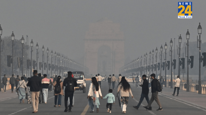
Delhi-NCR Live Updates: Air Quality Remains Poor at 29 Monitoring Stations in Delhi

---Advertisement---