Tamil Nadu’s Disaster Management Minister K.K.S.S.R. Ramachandran said on Sunday that Cyclone Ditwah has caused three deaths in the state due to rain-related incidents. He added that around 56,000 hectares of farmland have been submerged, including 24,000 hectares in Nagapattinam, 15,000 in Tiruvarur, and 8,000 in Mayiladuthurai.
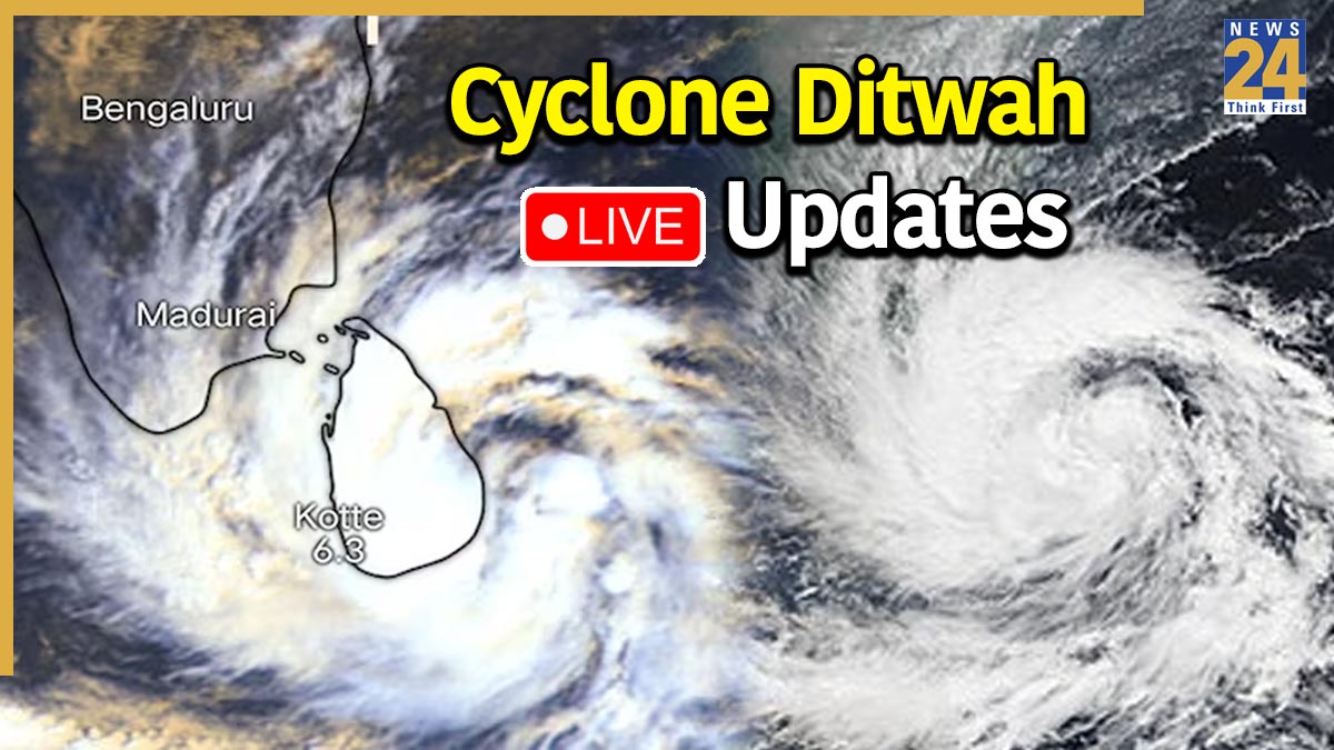
Cyclone Ditwah Highlights: The India Meteorological Department (IMD) on Sunday shared an update regarding the movement of Cyclone Ditwah. The Met Department has issued a red alert across several Tamil Nadu districts as the cyclone nears the Tamil Nadu-Puducherry-South Andhra Pradesh coasts. Extensive precautionary measures are in place, with several districts already experiencing heavy rain and strong winds.
Rain Alert In Multiple Districts
Kancheepuram, Chennai, Chengalpattu, Vellore, Tirupattur, Krishnagiri, Dharmapuri, Tiruvannamalai, Villuppuram, Tiruvallur, and Ranipet districts are expected to receive torrential rain on November 30 due to Cyclone Ditwah. Meanwhile, Incessant rains are also likely to batter Salem, Kallakurichi, and Cuddalore districts. Thousands of relief camps have been set up, while NDRF and SDRF teams are deployed to combat the cyclonic storm.
Cyclone Ditwah Nears TN, Puducherry Coasts, Flights Cancelled
The Chennai Airport has cancelled 47 flights, out of which 36 are domestic and 11 are international, scheduled for today, according to reports. During the next 24 hours, Cyclone Ditwah is very likely to move northwards parallel to the North Tamil Nadu-Puducherry coasts.
The IMD tweets, “during past 6 hours and lay centered at 2330 hrs IST of yesterday, the 29th November 2025 over southwest Bay of Bengal and adjoining North Tamil Nadu- Puducherry coasts, near latitude 10.7°N and longitude 80.6°E, about 90 km east-northeast of Vedaranniyam (India), 90 km east-southeast of Karaikal (India), 130 km north-northeast of Jaffna (Sri Lanka), 160 km south-southeast of Puducherry (India) and 260 km south of Chennai (India).”
Cyclone Ditwah LIVE Updates:
As Operation Sagar Bandhu moves ahead at full speed, providing help and support to Sri Lanka after the destruction caused by Cyclone Ditwah, External Affairs Minister S. Jaishankar said that NDRF teams are working closely with Sri Lankan officials to carry out relief efforts across the island.
Continuous rainfall over the past few days, caused by the approaching Cyclone Ditwah, has led to waterlogging outside the sanctum sanctorum (garbhagriha) of the Arulmigu Vedaranyeswara Swamy Temple.
#watch | Nagapattinam, Tamil Nadu | Due to the rains over the past few days, as a result of the nearing cyclone Ditwah, rainwater has accumulated outside the sanctum sanctorum (garbhagriha) of the Arulmigu Vedaranyeswara Swamy Temple. pic.twitter.com/pfsrMFSbCw
— ANI (@ANI) November 30, 2025
The Nellore district administration has been placed on high alert as Cyclone Ditwah approaches. Several areas recorded heavy rainfall on Sunday morning. The downpour in the upper catchment regions has caused a significant inflow of floodwater into the Somasila reservoir. Consequently, the Penna River is flowing strongly due to the increased water levels. According to the India Meteorological Department (IMD), Cyclone Ditwah is likely to move almost northwards, running parallel to the North Tamil Nadu-Puducherry coasts over the next 24 hours.
Nellore, Andhra Pradesh: Rain lashes several parts of Nellore. As per IMD, the Cyclonic Storm Ditwah is very likely to move nearly northwards parallel to the North Tamil Nadu-Puducherry coasts during the next 24 hours. While moving northwards, the cyclonic storm will be centred over the southwest Bay of Bengal within a minimum distance of 70 km and 30 km from the Tamil Nadu-Puducherry coastline by noon and evening of today, the 30th November.
#watch | Nellore, Andhra Pradesh: Rain lashes several parts of Nellore As per IMD, the Cyclonic Storm #ditwah is very likely to move nearly northwards parallel to the North Tamil Nadu-Puducherry coasts during the next 24 hours. While moving northwards, the cyclonic storm will… pic.twitter.com/sQNBJdMvBN
— ANI (@ANI) November 30, 2025
The India Meteorological Department (IMD) has hoisted Danger Signal Number 5 (D-V) at Cuddalore Port as Cyclone Ditwah intensifies. The signal indicates that a cyclonic storm of slight to moderate intensity is likely to cross the coast with the port lying to its left.
The Cyclonic Storm Ditwah [Pronunciation: Ditwah] over southwest Bay of Bengal and adjoining north Tamil Nadu-Puducherry coasts moved nearly northwards with the speed of 07 kmph during past 6 hours and lay centered at 0530 hrs IST of today, the 30th November 2025 over the same… pic.twitter.com/FyLkUr0yJj
— India Meteorological Department (@Indiametdept) November 30, 2025
New Delhi: In the wake of Cyclone Ditwah bearing down on Tamil Nadu, Union Minister for Railways, Information & Broadcasting, and Electronics & Information Technology, Ashwini Vaishnaw, reviewed preparedness measures with General Manager and teams of Southern Railways to ensure minimum disruption to rail services and ensure safety for passengers and coastal populations.
Tamil Nadu: Chengalpattu witnesses heavy rainfall due to the impact of Cyclone Ditwah. As per IMD, the Cyclonic Storm Ditwah is very likely to move nearly northwards parallel to the North Tamil Nadu-Puducherry coasts during the next 24 hours. While moving northwards, the cyclonic storm will be centred over the southwest Bay of Bengal within a minimum distance of 70 km and 30 km from the Tamil Nadu-Puducherry coastline by noon and evening of today, the 30th November.
#watch | Tamil Nadu: Chengalpattu witnesses heavy rainfall due to the impact of #cycloneditwah As per IMD, the Cyclonic Storm Ditwah is very likely to move nearly northwards parallel to the North Tamil Nadu-Puducherry coasts during the next 24 hours. While moving northwards,… pic.twitter.com/ffBeiRdlX9
— ANI (@ANI) November 30, 2025
Chennai, Tamil Nadu: Strong winds and rough sea conditions were witnessed in the capital city as the effect of Cyclone Ditwah intensified. Visuals from Marina Beach. As per IMD, the cyclone is to make landfall today
#watch | Chennai, Tamil Nadu | Strong winds and rough sea conditions witnessed in the capital city as the effect of #cycloneditwah intensifies. Visuals from Marina Beach.As per IMD, the cyclone is to make landfall today pic.twitter.com/fvOd1By8g1
— ANI (@ANI) November 30, 2025
Puducherry: A tourist says, "We came to Puducherry yesterday for our trip, but then we came to know about the cyclone and for our safety, they (officials) are not allowing us to go near the sea. We are following the rules. We will leave today."
#watch | Puducherry: A tourist says, "We came to Puducherry yesterday for our trip, but then we came to know about the cyclone and for our safety, they (officials) are not allowing us to go near the sea. We are following the rules. We will leave today."#cycloneditwah https://t.co/Xh0ufFEEK3 pic.twitter.com/JthaO09w6u
— ANI (@ANI) November 30, 2025
Puducherry witnesses rough sea conditions as an effect of cyclone Ditwah in the Bay of Bengal.
#watch | Puducherry witnesses rough sea conditions as an effect of cyclone Ditwah in the Bay of Bengal. pic.twitter.com/RiJIu58WEx
— ANI (@ANI) November 30, 2025
Tamil Nadu: A red alert has been issued by the Indian Meteorological Department for Cuddalore due to Cyclone Ditwah.
#watch | Tamil Nadu | A red alert has been issued by the Indian Meteorological Department for Cuddalore due to Cyclone Ditwah. pic.twitter.com/SbM466G5CI
— ANI (@ANI) November 30, 2025
The India Meteorological Department (IMD) has shared an update regarding the movement of Cyclone Ditwah during the early hours of Sunday. A red alert has been sounded across several Tamil Nadu districts as the cyclone nears the state’s coast. Extensive precautionary measures are in place, with several districts already experiencing heavy rain and strong winds. Light to moderate rain is most likely to lash Puducherry and Karaikal areas today, accompanied by thunderstorms and lightning at one or two places.
Cyclonic Storm Ditwah continued to drift northward at a slow pace of 5 kmph over the southwest Bay of Bengal and the adjoining north Sri Lanka-Tamil Nadu coasts. As of 2:30 AM on November 30, the system was located near latitude 10.8°N and longitude 80.6°E, about 80 km east of Karaikal, 100 km east-northeast of Vedaranniyam, 140 km north-northeast of Jaffna, 160 km south-southeast of Puducherry, and 250 km south of Chennai.


